
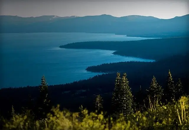

LAKE TAHOE MOUNTAIN BIKE FACT SHEET
The following list describes some of Lake Tahoe’s favorite mountain bike trails. Local sport shops also have the most current information and a wealth of knowledge about local trails: The Back Country in Truckee 530-582-0909; Enviro-Rents Sports in Kings Beach 530-546-2780; Olympic Bike Shop in Tahoe City 530-581-2500; Porters Ski and Sports (with Tahoe City, Truckee and Incline Village locations) 530-583-2314; Cyclespaths Mountain Bike Adventures on the West Shore and in Truckee 530-581-1171; Northstar-at-Tahoe Mountain Biking in Truckee 530-562-1010; Paco’s Bike & Ski in Truckee 530-587-5561; Trailhead Mountain Bike Rentals at the Flume Trail trailhead 775-749-5349; Tahoe City Bikes in Tahoe City 530-581-5861; and Village Bicycles 775-831-3537 in Incline Village. Riders can also pick up maps at the North Lake Tahoe Visitors Center at 380 North Lake Boulevard in Tahoe City.
The United States Forest Service offers a detailed “adventure” map, available for $9.99 plus tax (Forest Service, Lake Tahoe Basin Management Unit, 35 College Drive, South Lake Tahoe, California 96150, 530-543-2600 or visit the website at www.fs.fed.us).
1 Fountain Place
Easy/ Moderate
6320’/ 8400’
One-way 2 miles
2 Angora Ridge
Moderate
6360’/ 7440’
One-way 2 miles to Angora Look-out and 4 miles to Angora Lakes
3 Twin Peaks
Moderate/ Strenuous
6400’/ 7010’
One-way 1 to 2 miles
4 Stanford Rock
Moderate/ Strenuous
6300’/ 7800’
One-way 5 miles
5 Tahoe Rim Trail
Moderate/ Strenuous
7280’/ 9600’
One-way 18 miles
6 Mr. Toad’s Wild Ride
Strenuous
6800’/ 9000’
One-way 3 miles
7 Fiberboard Freeway
Moderate
6200’/7300’
One-way 12 miles
8 Brockway Summit to Martis Peak
Moderate/ Strenuous
7120’/ 8660’
One-way 5 miles
9 McKinney Rubicon Road
Moderate/ Strenuous
6400’/ 7200’
One-way 6 to 15 miles
10 Marlette Lake & The Flume Trail
Strenuous
7000’/ 8300’
One-way 5 miles to Marlette Lake; 23 mile loop on Flume Trail
1) Fountain Place
This area has several mountain biking opportunities, from paved roads to more difficult trails. See the map for your options. NOTE: Mountain bikes are not allowed past the gate at the end of Fountain Place Road nor the High Meadows area (private property). From Highway 50 take Pioneer Trail one mile to Oneidas Road. Follow Oneidas to the end and park at the staging area.
2) Angora Ridge
Enjoy a moderate ride with spectacular views of Fallen Leaf Lake and Mt. Tallac. Take Fallen Leaf Lake Road from Highway 89. Park past the campground on the right. Ride along Fallen Leaf Lake Road, take the first left and turn right on Angora Ridge Road (12N14).
3) Twin Peaks
Perfect for the biker with limited time, this short steep ride to the top of a mountain peak has great views of Lake Tahoe. Open for public use from 9 a.m. to 7 p.m. daily. Access is off Lake Tahoe Boulevard approximately two miles from the intersection of Highway 50 and 89. Caution: This region is a very popular OHV Area.
4) Stanford Rock
This is a steep, challenging single-track descent on the Tahoe Rim Trail. Five miles south of Tahoe City on Highway 89 (just before Black Bear Tavern and after a small bike path bridge that spans Blackwood Creek), hop on a single-track and ride along the south side of the creek. Keep climbing for a mile or so, and bear left, avoiding a right turn that takes you across the creek. The Stanford Rock Trail is not signed, but is located at a huge boulder at the viewpoint.
5) Tahoe Rim Trail
Take the Tahoe Rim Trail past Freel Peak, the highest peak in the basin (10,881’). Take Highway 89 south of Myers at the Big Meadows parking lot. The trail starts at the north end of the parking lot. A longer trip is possible by taking two cars and parking one car at the Heavenly Valley Ski Resort’s Stagecoach parking lot. The trailhead begins 1/8 mile up Stagecoach Run. NOTE: Mountain bikes are not allowed on the trail from Armstrong Pass north to Fountain Place nor from Star Lake north to High Meadows (private property).
6) Mr. Toad’s Wild Ride
Technical ride for the experienced mountain biker, this trail drops from 9,000’ to 6,800’ in three miles. Take the Tahoe Rim Trail from Big Meadows parking lot two-and-half miles to Tucker Flat. Turn left and follow the drainage of Saxon Creek. In two miles the trail forks again. The right fork leads to Oneidas Street off Pioneer Trail. The left fork leads to highway 89, south of the Highway 89/50 junction. Watch for hikers and equestrian riders on the trail and pass with caution and courtesy.
7) Fiberboard Freeway
The Fiberboard Freeway is a moderate trail that is paved in some places and goes all the way to Brockway Summit from Tahoe City. It’s moderately steep and rocky in a few places and is the gateway to some amazing trails higher up. Leaving Tahoe City toward Truckee, turn right onto Fairway Drive, turn left onto Bunker Road and left onto a dead end street with a sign stating “Forest Protector Road”. Avoid turning onto other fire roads and start climbing a short technical trail, at the top, avoid the left single-track options and soon you’ll be coming down into a meadow. Just as you hit the meadow, turn left onto a single-track. Cross the meadow and soon you’ll pop out on the Fiberboard Freeway.
8) Brockway Summit To Martis Peak
The Martis Peak road is a short five-mile climb well worth the effort. Drive north on Highway 267 from Kings Beach to Brockway summit. Park past the summit on Forest Service road 18N02.
9) McKinney/Rubicon Road
A world class OHV road that offers a variety of biking opportunities from loop rides to difficult peak climbs. From Highway 89 north of Tahoma, California turn west onto McKinney-Rubicon Road, bear left onto McKinney-Rubicon Springs Road. Turn left on Bellevue, right on McKinney Road, bear left onto McKinney-Rubicon Springs Road, and continue to the dirt road and park. A longer ride is possible by taking two cars and parking one car at Blackwood Canyon.
10) Marlette Lake/Flume Trail
Challenging even the expert rider, the trail begins east of the picnic area near Spooner Lake. Turn left 1,500 feet above the lake. Remember to wear your helmet. Caution: Do not attempt if you are afraid of heights or unfamiliar with your bike. With magnificent views of Lake Tahoe, this single-track trail lies on the dirt road that heads toward the meadow and follow a sandy road for five miles to Marlette Lake. Turn left across the dam. The trail ends at Tunnel Creed Road. To make a loop, turn right and ride to the top of the ridge. You will reach Twin Lakes. 7/10’s of a mile past the lake sign, turn right or continue to the next main road and turn right. Turn right again on Forest Service Road 504, climb the ridge and where the road forks, continue straight to Marlette Lake. Take Highway 28 to the Spooner Lake parking lot at Nevada State Park. A parking fee is charged. If you have two cars, limited parking is available at Tunnel Creek Road by what once was Ponderosa Ranch.
11) Northstar-at-Tahoe Mountain Bike
Northstar’s mountain bike park, the largest in Northern California, has lifts accessing more than 100 miles of trails, including the resort’s signature trail LiveWire. The park will be open Fridays through Sundays beginning June 13 and Thursdays through Sundays July 2 through Labor Day, remaining open weekends until mid-October. Downhill and cross-country race series are offered throughout the summer.
Mountain Bike Options:
For a less strenuous bike excursion, the North Tahoe Bike System consists of flat, paved trails from Tahoe City to Squaw Valley, Sugar Pine Point State Park and Dollar Hill.
Media Contact:
Abbi Whitaker
(office) 775-323-2977
(cell) 775-722-2254
[email protected]